A ghost town where the land ends....
 A sunny Saturday afternoon found me heading west along the A394 through Penzance in search of an ancient, ruined village called Chysauster that occupies the South West slopes of the Carnaquidden Downs 4 miles north of Penzance on the Land's End Peninsula. The low-angled, late autumn sunshine offered a perfect opportunity to enjoy the contours of this abandoned settlement and a chance to imagine life on the peninsula almost 2000 years ago.
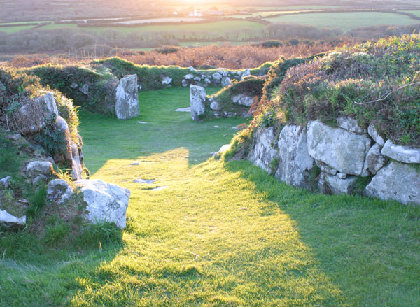 Dated to the later Iron Age, this ancient village is thought to have continued in use during the Roman occupation. Chysauster is a fantastic example of an Iron Age and Romano-British village. The village appears to have been built between the first and third centuries AD probably by the local Cornish Britons of the Dumnonii tribe.
The settlement was largely self-sufficient, growing its own cereal crops, supplemented by dairy produce and meat from livestock.
 Evidence for such a farming economy has been confirmed, and traces of food crop enclosures can still be seen. It was probably occupied for only a relatively short period. The courtyard houses are unique to West Penwith (Land's End Peninsula) and the Isles of Scilly.
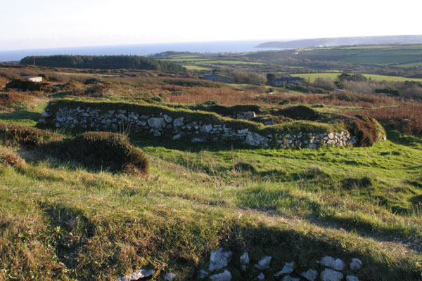
It is possible that the settlers bartered for what little they had by trading in nuggets of tin, which they collected from the streams and river-beds throughout the region. "Tin-streaming", as it is known, is thought to have brought the natives luxury goods by way of trade from the nearby port of Ictis (St. Michael's Mount).
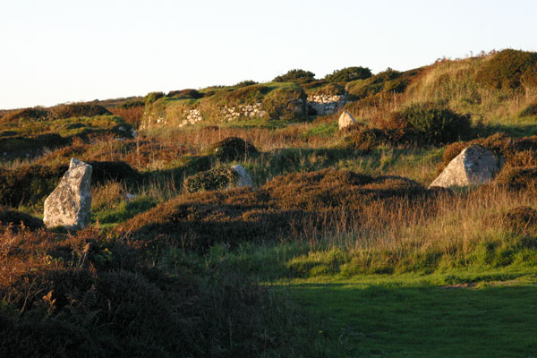
A field system in the vicinity indicates that Chysauster was a farming community. The nearby hill fort of Castle-an-Dinas may have been a contemporary refuge for the occupants of the village in times of strife.
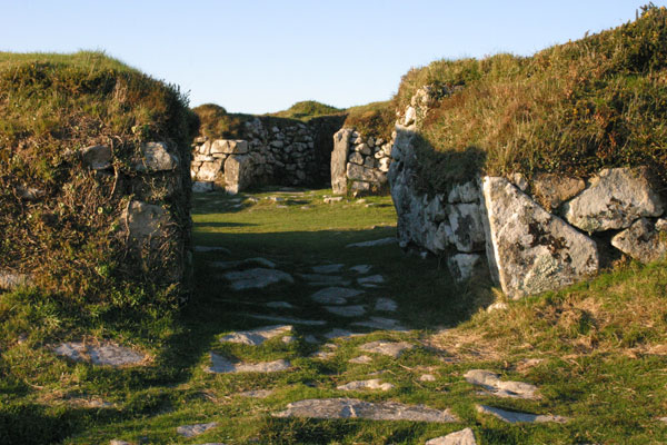
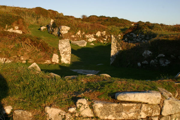
There are nine large oval houses, eight of which are arranged in pairs along a street. Some are very well preserved. There are also the remains of several outlying buildings in the surrounding fields.
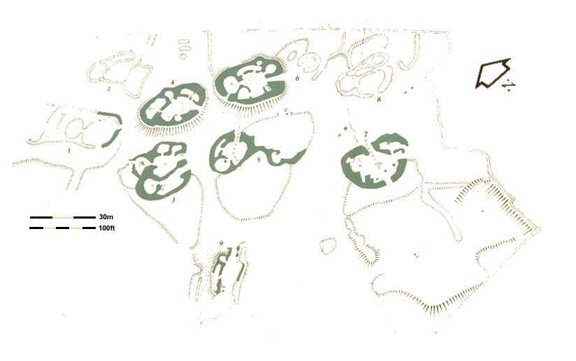
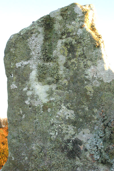
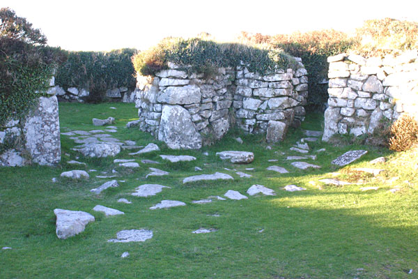
Each dwelling is an oval shaped stone-built complex around 28 metres long oriented on an east-west axis, with the entrance in the east. The basic plan of each house consists of a central open courtyard which leads to circular living room opposite the entrance. Smaller rooms are built into the walls which may have been used for storage and keeping animals.
The walls are as thick as 4m in places and survive to heights of up to 3 metres. They may once have been plastered with mud and limewashed like more recent houses.
The main rooms feature a central flat stone socket hole, for a wooden post to support the thatched or turf roof. In some of the houses there is evidence of open hearths, covered stone drains and a stone basin or 'quern' for grinding grain can be seen at the site. The remains of terraced garden plots can be seen attached to the houses.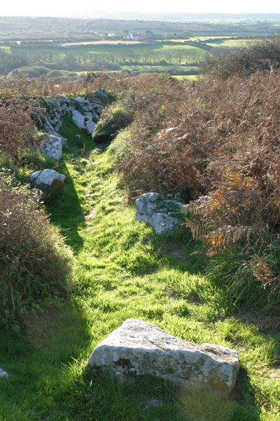
The site has been excavated on many occasions, and some reports claim that several sections of the village were incorrectly reinstated in the wake of previous excavations.
The site also contains a fogou (Cornish for cave) - an underground chamber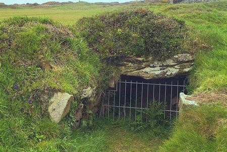 of unknown purpose. The fogou at Chysauster is in a derelict state and was blocked up in the 1980's for safety reasons. A much better example of a fogou canbe found at Carn Euny.
 In the early nineteenth century, people came to Chysauster to listen to Methodist preachers who liked to use the village as an open-air pulpit. Now the site is maintained by English Heritage.
Sources:
megalithic.co.uk
roman-britain.org
cornwall-online.co.uk
english-heritage.org.uk
britain-express.com
themodernantiquarian.com
posted by Mark Schofield at 10:03 PM
![]()
![]()


0 Comments:
Post a Comment
<< Home